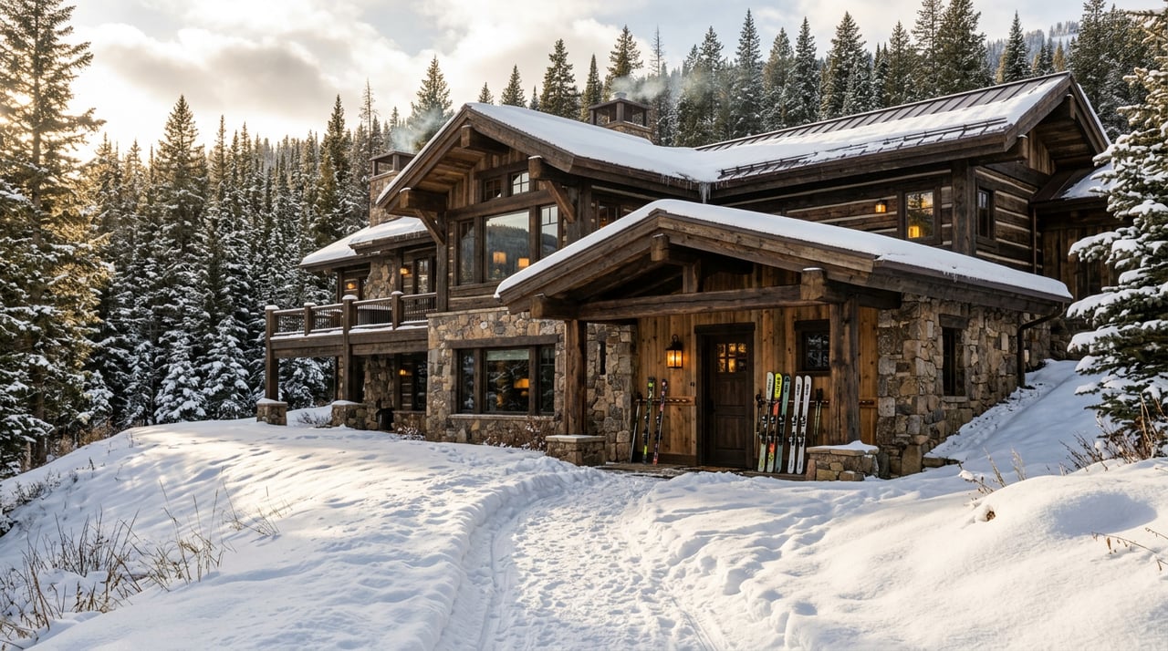
You sip your coffee, step into warm boots, and click into your skis a few steps from the mudroom. No shuttles. No hauling gear through a parking lot. At The Colony at White Pine Canyon, ski time replaces transit time. In this guide, you’ll see how “true” ski-in/ski-out works here, what a winter day actually feels like, and what to verify when you evaluate a specific homesite. Let’s dive in.
What ski-in/ski-out means here
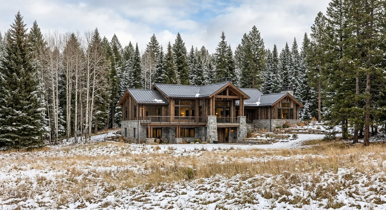
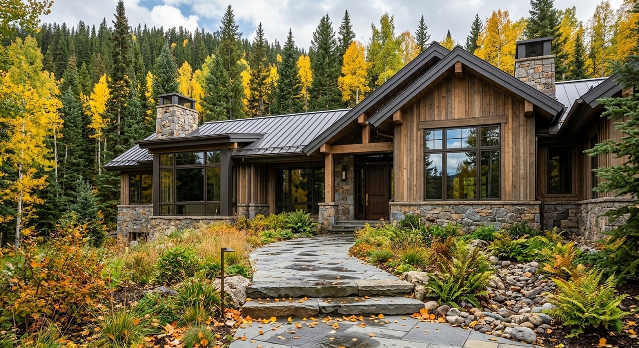
The Colony is a gated, mid-mountain community inside the Park City/Canyons area, with sales materials listing the address as 2455 White Pine Canyon Rd. It is a master-planned environment where private land, recorded easements, and ski infrastructure are designed to work together. The master plan provides for up to 274 homesites across roughly 4,600 acres, with most acreage preserved as open space under recorded guidelines and plats. You can review the development controls and planning framework in the community’s official Design & Development Guidelines, which govern building envelopes, site coverage, and ski-trail protections.
- Learn more about the property’s location and master-planned context on the project page at The Colony’s site.
- For technical rules that shape ski access and site planning, see the recorded Design & Development Guidelines.
The ski-in/ski-out experience is delivered through a network of recorded ski easements and private groomed lanes that link homes to named Park City Mountain runs and lifts. Which lift you reach first depends on your lot location. Common touchpoints include Dreamcatcher, Dreamscape, Daybreak, Tombstone Express, Iron Mountain Express, and the Quicksilver Gondola. Refer to the resort’s official trail map for current lift names and mountain connections.
thecolonywpc.com/the-colony-project
thecolonyhoa.org — Design & Development Guidelines
Park City Mountain official trail map
Doorstep to lift: how access works
In practice, a typical route looks like this: front door to ski room, skis on, then a short glide on a private, groomed lane that merges onto an in-bounds run. From there, you ride the nearest lift and begin your laps. The exact pattern is lot-specific, and the legal underpinnings are recorded in plats and easements.
- The community uses recorded ski easements and, where needed, plat amendments so access aligns with the resort’s on-the-ground trail locations. A public staff report for a Lot 71 amendment is a good example of how these adjustments are documented.
- Developer homestead maps illustrate intended private ski lanes and conceptual alignments. Treat these as visual guides and confirm all routes against recorded plats and HOA documents.
Summit County staff report example
Conceptual homestead ski-out map
Lower, mid, or upper: access by area
While every homesite is unique, buyers often describe three broad access patterns. Use the resort map and recorded documents to verify specifics for any address.
- Lower-side lots: Shortest routes to Daybreak, Dreamcatcher, and adjacent green/blue terrain. These are straightforward for warm-up laps and varied groups. See the official trail map for lift placement.
- Mid-mountain lots: Central Meadow and Pinecone areas often feed into intermediate runs with quick reach to Tombstone or Iron Mountain zones via private lanes and nearby connectors.
- Upper lots: The highest-elevation parcels can place you closest to upper-mountain lift networks, including fast links toward the Quicksilver Gondola. Expect more exposure to wind and colder mornings.
Park City Mountain official trail map
A winter day, start to finish
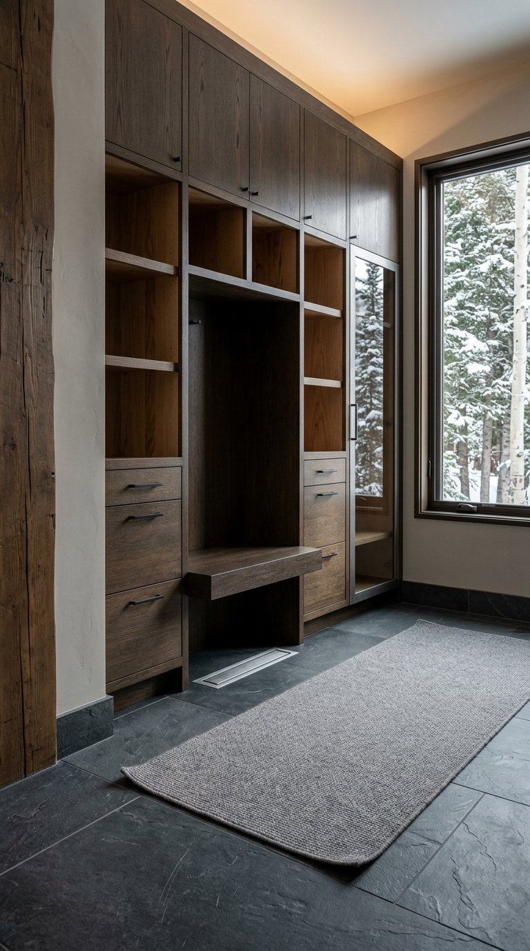
Morning is simple. You gear up in a purpose-built ski room, step onto a groomed private lane, and glide to an in-bounds run. Your first chair could be Tombstone, Iron Mountain, Daybreak, or a nearby lift, depending on your address and the day’s grooming choices shown on the resort’s map.
Mid-day, you can lap local zones or cross between the Canyons Village and Park City Mountain Village sides using the Quicksilver Gondola and mid-mountain connections. Always consult the official trail map and live resort resources for operating lifts and routes.
In the afternoon, returning home usually means an easy ski-down to your lane, then a smooth glide to the house. Some properties advertise specialty features like private snowcat shuttles or on-parcel uphill conveyances. Treat these as seller-reported, property-specific items and verify them through the HOA and recorded documents before you rely on them.
Park City Mountain official trail map
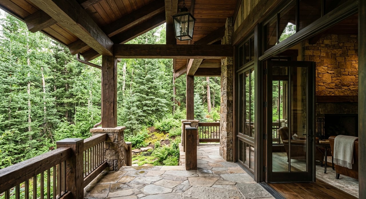
Why it feels so private
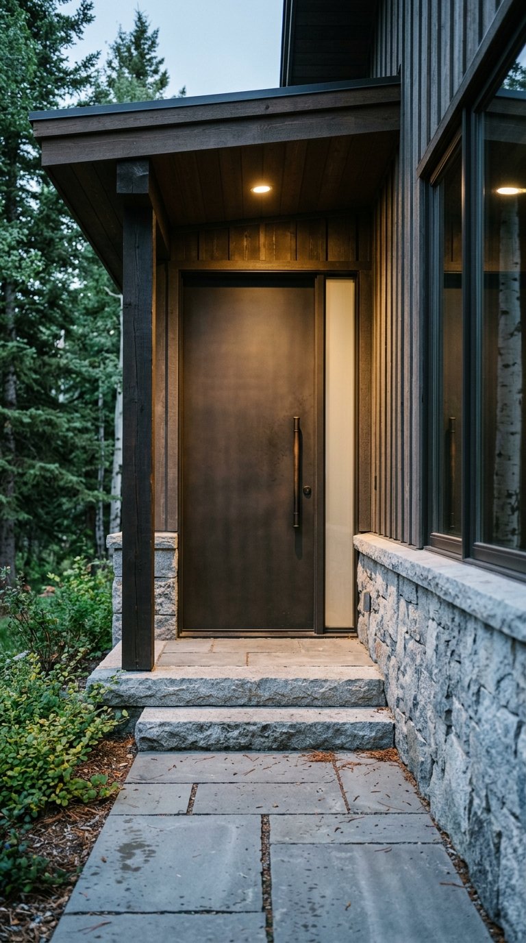
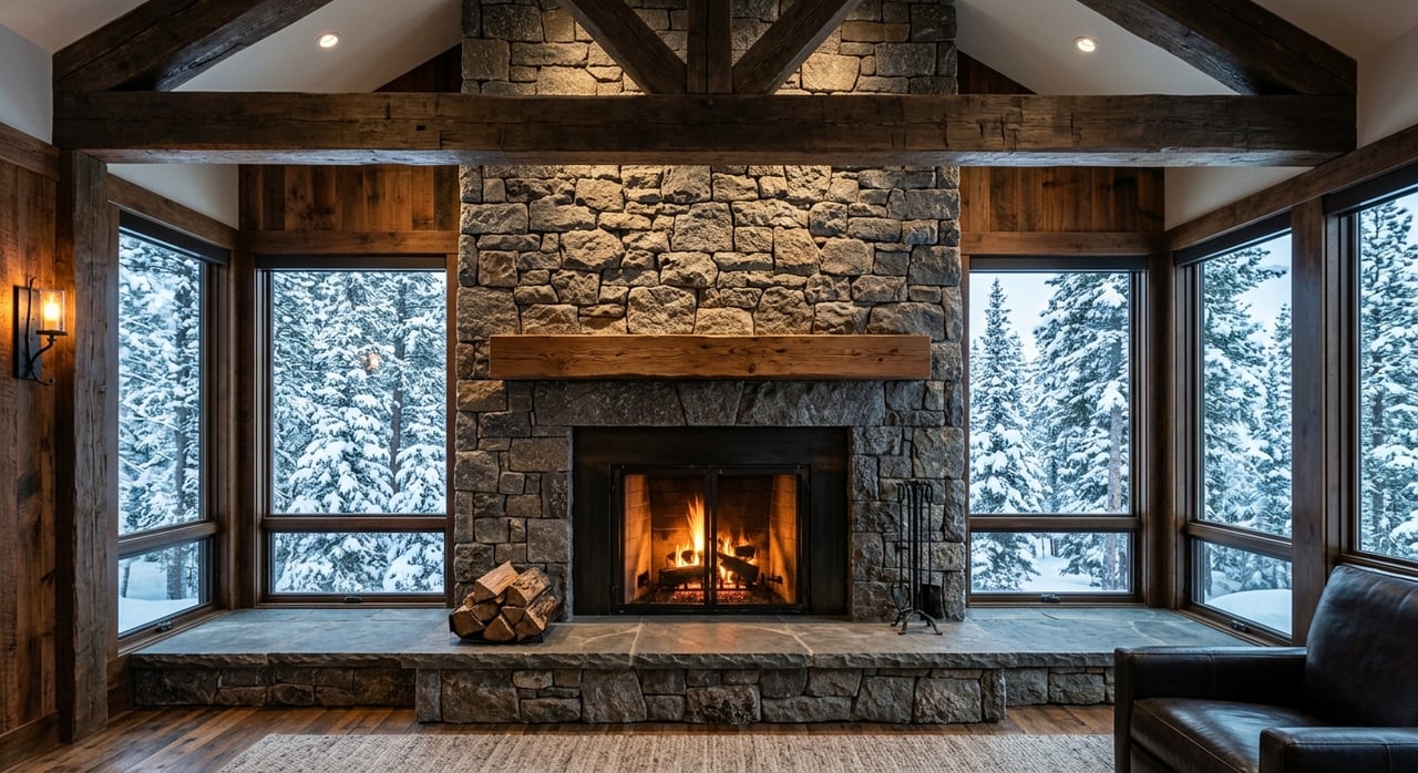
The Colony’s privacy comes from its planning. Each homesite has a defined development envelope and driveway corridor, with the remainder preserved as natural open space. Total site coverage is capped, and the HOA’s SARC review concentrates building mass so ski corridors and view sheds remain intact. The Guidelines also treat ski trails as managed infrastructure, placing seasonal limits on construction that could affect access.
- Building envelopes and site coverage limits keep most acreage open.
- Roads are paved and utilities are placed underground per the community’s infrastructure plan.
- Fire mitigation and vegetation controls shape driveway design, snow storage, and defensible-space requirements.
All of these add up to a quiet, on-mountain feel even on high-traffic days, with groomed lanes and forested buffers guiding you to and from the resort.
Design & Development Guidelines
What to verify for any property
Before you fall in love with a view or a floor plan, confirm the on-mountain details. Use recorded documents and the official resort map as your source of truth.
- Nearest runs and lifts: Identify named runs and first lifts from the property. Confirm whether you reach them via a private Colony lane or a public in-bounds run using the official trail map and the recorded plat.
- Recorded ski easements: Check for easements on the lot or adjacent lots in Summit County records. The Lot 71 staff report shows how these are documented.
- Development envelope and site coverage: Review the lot’s recorded exhibits and the HOA Guidelines for SARC conditions and the 20,000 sq ft total site coverage framework.
- Elevation and exposure: Higher parcels can be colder and windier; lower parcels sit closer to the gate and may have different snow conditions. Confirm specifics with recorded data and site visits.
- Private services: If a listing mentions a private snowcat or uphill device, treat it as property-specific and verify permission and operations with the HOA and recorded documents.
- Rental/use rules: Review CC&Rs and county zoning for permitted uses and any short-term rental restrictions. Do not assume nightly rental rights without documentation.
Park City Mountain official trail map
Summit County staff report example
Design & Development Guidelines
Guest access and winter logistics
The Colony is gated, and guest access is managed at the gatehouse under HOA rules. Plan your hosting with clear arrival instructions and parking guidance. The wider Canyons area has added gating and parking enforcement in response to trespass concerns, so it pays to organize guest permits and avoid on-resort parking pressure.
KPCW report on gating and parking measures
Building for on-mountain life
If you are purchasing a homesite, design choices that respect the Guidelines will protect your access and privacy.
- Site planning: Fit the main residence, guest structures, and outdoor spaces within the development envelope to maintain open-space buffers and ski corridors.
- Ski trail protections: Expect seasonal limits on construction activity that could affect ski trails during the core ski season.
- Accessory structures: Many parcels allow a guest house and other accessory buildings subject to SARC review and footprint limits outlined in the Guidelines.
- Safety and infrastructure: Underground utilities, paved roads, and fire-mitigation standards inform driveway design, snow storage, and defensible space.
Design & Development Guidelines
Start your on-mountain search
If you are drawn to the idea of stepping into skis at your door and gliding into 7,300 acres of terrain, focus your search on the route from each doorway to the first lift. Confirm easements, understand the building envelope, and picture your daily laps on the official trail map. When you are ready, schedule a private, on-mountain tour to see how each homesite connects to the resort in real life.
Ready to experience it in person? Schedule a Private Tour with The Colony at WPC.
FAQs
What does “true” ski-in/ski-out mean at The Colony?
- It means recorded ski easements and private groomed lanes intentionally link homesites to in-bounds runs and lifts; verify each property’s route with recorded plats, HOA Guidelines, and the official Park City Mountain trail map.
Which lifts are typically closest to Colony homes?
- Proximity varies by lot, but many residents connect quickly to Daybreak, Dreamcatcher, Dreamscape, Tombstone Express, Iron Mountain Express, or the Quicksilver Gondola as shown on the resort’s official map.
How do the HOA rules affect ski access and design?
- The Design & Development Guidelines require building within defined envelopes, cap total site coverage, and place seasonal protections on ski trails, which preserves clear access and open-space buffers.
Can I ski from my home to the Park City Mountain Village side?
- Yes, you can cross between the Canyons Village and Park City Mountain Village sides using the Quicksilver Gondola and mid-mountain connections; always consult the official resort map for current routes.
Are short-term rentals allowed inside The Colony?
- Rental rights depend on CC&Rs and county zoning; review the recorded HOA documents and local code before assuming nightly rental permissions.
How do guests enter the community during winter?
- The Colony is gated with guest access managed by the gatehouse under HOA rules; plan permits and parking in advance, as the wider area has implemented gating and parking controls in response to trespass issues.